 Skip to content
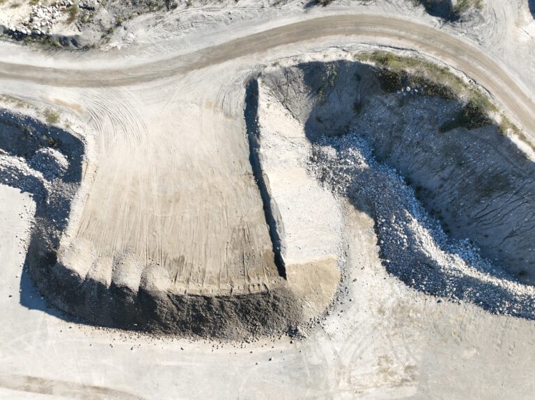
 As a Maine drone service provider with more than 10 years of experience, I’ve seen firsthand how construction companies and gravel pit operators struggle with stockpile measurement costs. Traditional methods are slow, expensive, and often inaccurate — which leads to billing issues, material shortages, and costly overages.
Drone volumetric measurements have changed all of that. I recently completed an aerial stockpile survey in Maine, saving the company north of $15,000 by using fast, precise drone-based stockpile surveys. Let me reiterate, the savings was just on one project! I realise that this seems far fecthed but it did accuatly happen and it is not typical of many projects.
Why Drone Stockpile Measurement Is Growing in Maine?
Whether you’re managing gravel, aggregate, salt, loam, asphalt millings, or raw earthwork materials, knowing your stockpile volumes is essential. Contractors tell me all the time that traditional measurement methods were:
*Too slow
*Too expensive
*Too inconsistent
*Too dangerous to perform manually
Drone volumetric mapping solved all of that.
A 20-minute drone flight provides the same (or better) data than hours of climbing piles with a GPS rover — and with far more accuracy.
The Cost of Traditional Stockpile Surveys
Traditional surveys often require:
* A survey crew
* On-site time walking piles
* Manual measuring tools
* Additional safety precautions
*Equipment rental
By the time the job is complete, contractors may spend $3,000–$5,000 per survey — often several times a year.
Worse, manual methods commonly produce 10–20% volume errors, which can cost a contractor tens of thousands of dollars in material discrepancies.
How Drone Volumetrics Cuts $15,000+ in single visit
Aerial stockpile measurement removes nearly all of the labor and equipment expenses. With drones:
Measurement costs drop by 60–80%
Projects require no shutdown
Results are delivered within 24–48 hours
Accuracy improves dramatically
These savings quickly add up. Contractors using drone surveys typically save:
$15,000+ on Single visit stockpile measurement costs alone.
Accuracy That Eliminates Expensive Overages
One of the highest hidden costs in material management is inaccurate volume reporting. Drone photogrammetry produces sub-inch accuracy, reducing:
Overbuying material
Underbilling clients
Costly disputes
Production delays
Better accuracy means better profit margins.
Fast Turnaround Times Keep Projects Moving
In construction, delays cost money. That’s why our Maine drone service is built for speed: Most stockpiles can be flown in under 30 minutes Processing is typically completed within 24–48 hours Contractors get detailed 3D models, orthomosaics, and PDF volume reports You get the data you need without slowing down your operation.
Real-World Example: How We Saved a Maine Contractor $15,000
One of our recent clients — a large contractor in central Maine — was spending thousands on traditional stockpile surveys. After switching to our drone service, they reduced:
Survey costs
Labor time
Material overages
Reporting errors
In a single season, their savings totaled over $15,000 simply by switching to drone-based volumetrics.
What You Get With Our Drone Stockpile Service
Every stockpile measurement includes: High-resolution aerial imagery 3D surface model (DSM) True volumetric calculations Orthomosaic map PDF volume report CSV data export for inventory systems Flight logs for compliance You get accurate, reliable data delivered in a clean reporting format.
Service Coverage Across Maine
We provide drone stockpile measurement services throughout the state, including:
*Portland
*Bangor
*Lewiston/Auburn
*Augusta
*Waterville
*Midcoast
*Down East
*Northern Maine
Mill sites, gravel pits, quarries, and job sites statewide
If you have a stockpile, we can measure it.
Get a Quote for Your Next Stockpile Measurement
If you’re ready to reduce costs, improve accuracy, and eliminate guesswork, our Maine drone service can help.
Contact us today for a fast, no-pressure quote. or 207-841-2078
