 Skip to content
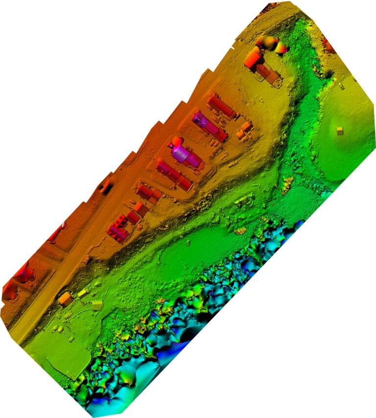
Drones are incredible tools. They fly, they photograph, they measure, and they make clients say things like, “Wow, that’s cool.” However, here’s the uncomfortable truth: owning a drone does not mean you’re collecting good data.
In fact, many teams are unknowingly making the same drone data collection mistakes over and over again. As a result, they end up with fuzzy imagery, questionable measurements, and reports that look nice but don’t actually help anyone make decisions.
So, if your drone data feels underwhelming—or worse, unreliable—you’re not alone. Let’s talk about why.
Common Drone Data Collection Mistakes
1. Flying Without a Clear Data Objective
First and foremost, flying without a plan is one of the most common drone data collection errors. If you don’t know why you’re flying, the data usually won’t know what it’s supposed to do either.
Are you measuring? Inspecting? Documenting progress? Without a clear objective, flights tend to produce random imagery that looks impressive but solves exactly zero problems.
Best practice: Decide what questions the data needs to answer before takeoff. Otherwise, you’re just sightseeing with extra paperwork.
2. Inconsistent Flight Planning
Next, let’s talk about inconsistency. Poor drone data collection practices often show up as different altitudes, random angles, or “we’ll just eyeball it” flight paths.
Unfortunately, inconsistency leads to gaps, distortion, and data that can’t be compared from one flight to the next.
Best practice: Use repeatable flight plans with consistent altitude, overlap, and camera settings. Consistency isn’t boring—it’s accurate.
3. Prioritizing Speed Over Data Quality
Sure, fast flights feel efficient. However, rushing is a guaranteed way to create drone data capture mistakes like motion blur, weak overlap, or incomplete coverage.
In other words, saving five minutes in the air can cost hours in post-processing—or worse, force a return trip.
Best practice: Slow down. Clean, sharp data beats fast, sloppy data every single time.
4. Ignoring Environmental Conditions
Meanwhile, wind, lightning, and shadows are quietly sabotaging more drone projects than most people realize. Flying at the wrong time of day or in marginal weather can significantly reduce drone inspection data accuracy.
Just because the drone can fly doesn’t mean it should.
Best practice: Plan flights around optimal lighting and weather windows whenever possible. Mother Nature always gets a vote.
5. Treating the Drone as the Product
Finally—and this one’s big—the drone itself is not the deliverable. The data is.
Too many teams focus on the aircraft, the flight, or the cool factor, while ignoring what happens after the props stop spinning. As a result, valuable data never turns into actionable information.
Best practice: Build workflows around data processing, validation, and delivery. The drone is just the tool—not the outcome.
How to Improve Drone Data Collection
Use Proven Drone Data Collection Best Practices
Standardized workflows, trained pilots, and documented procedures dramatically reduce drone data collection mistakes. More importantly, they create data you can trust.
Focus on Accuracy, Not Just Visuals
Yes, pretty images are nice. However, accurate drone data supports measurements, comparisons, and real decisions—which is where the real value lives.
Work With Experienced Drone Professionals
Experience matters. Seasoned operators understand how flight planning, sensors, and environmental factors all impact final data quality.
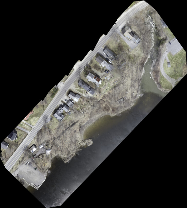
Why Drone Data Accuracy Matters
In industries like construction, roofing, and facility management, bad data doesn’t just look bad—it costs money. Inaccurate drone data often leads to:
Incorrect measurements
Missed defects
Costly rework or change orders
Low confidence in reports
On the flip side, improving drone data accuracy leads to better decisions, clearer communication, and fewer surprises.
Final Thoughts
At the end of the day, drones are only as good as the data they collect. If you’re flying regularly but still struggling with results, chances are drone data collection mistakes are the real issue—not the technology.
By tightening your planning, improving consistency, and focusing on data quality, drones become more than a flashy gadget. They become a reliable decision-making tool.
And honestly, that’s when drones start paying for themselves.
If you would like to know more about other related topic check them out here. From Blueprints to Reality,and Drones in Construction.
